Uncategorized

Perolniyoq, Intipunku Loop

A Zeke adventure 🙂

A couple days ago, I did a 22.7 mile loop starting and ending in Ollantaytambo. I started out of town, across the bridge over the river, and out the road that heads in the direction of the Cerveceria del Valle Sagrado. After not long, I peeled off, up a little trail that steadily climbs the mountain. I did this first part a couple weeks ago, in my first attempt at the loop, but I got tired and ran out of time. This time I had left at six am, giving myself a turnaround time at around 12, so I would have up to 12 hours to do the loop if I needed it. My trail continued up, fairly nice and clear early on, but soon I was pushing through wildflowers that had overgrown the trail. Most of the ascent was like this– a fairly narrow trail with dense wildflowers overgrowing it from the uphill side, and occasionally both sides. I took a few breaks, but kept up a decent pace.

My trail was often like this, or less visible, just a narrow track on the ground.
Looking back towards Ollanta
Looking up the valley, in the direction of Urubamba

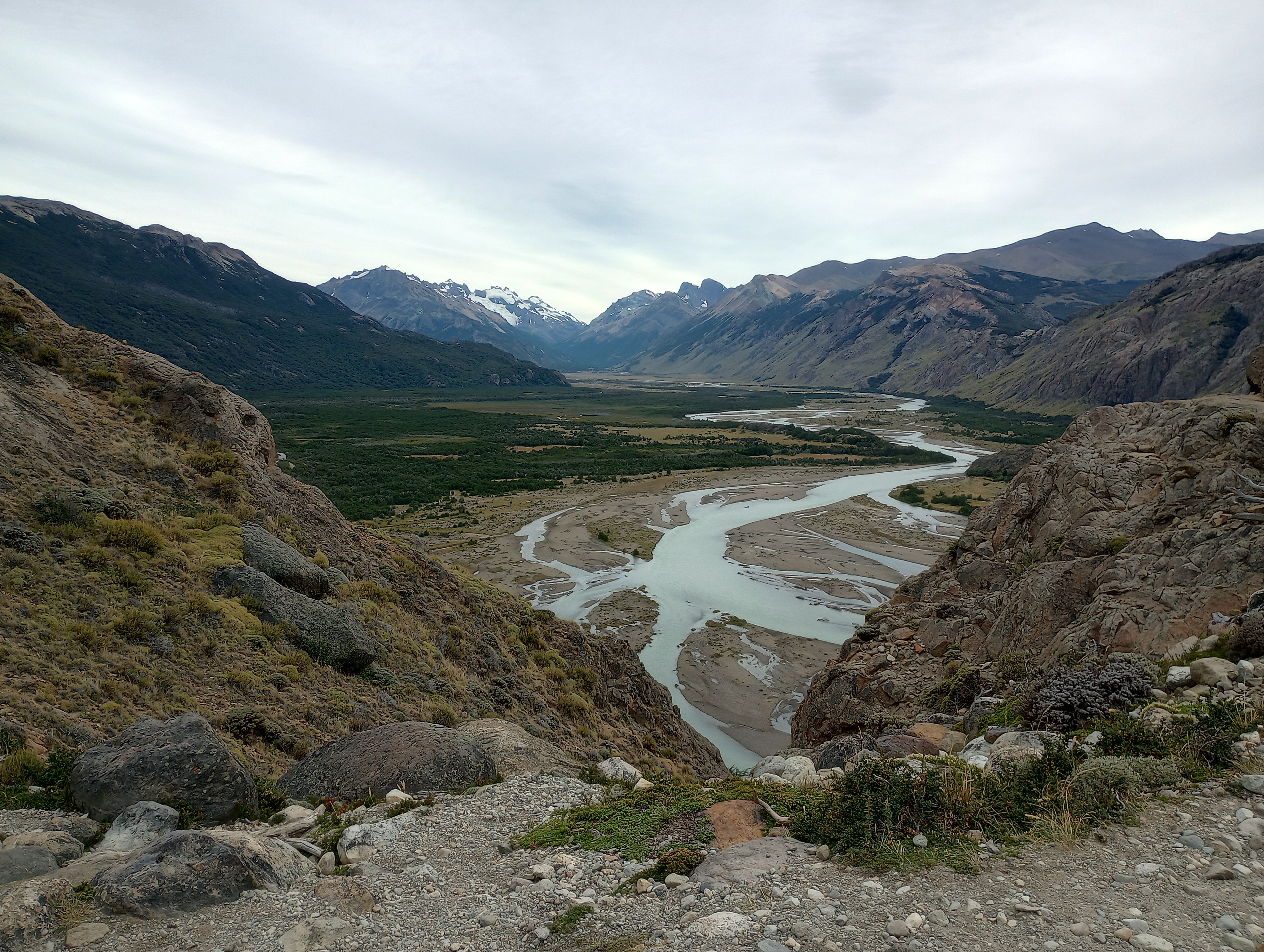
The trail eventually rounded the corner of the mountain, taking me away from the central valley and up another one, then gradually turning to enter an even smaller valley. In my first attempt, I had descended down all the way into the valley, before ascending to a waterfall on the way, and was planning to do the same. A little bit after a trail split, I ran into two campesino (country, rural) men, and they told me in mixed Spanish and Quechua that it would save me a lot of up and down to take the old Inca trail, which ran higher up the valley and didn’t descend down into it. I had missed the turnoff for this trail, so I hiked back up for a little with them, before they pointed out a small path that would connect up to the Inca trail.

Soqma is spread out in this Valley
The waterfall, which I didn’t go to this time but did a few weeks earlier.

I took it, which ended up being part walking, part scrambling, and soon reached the Inca trail. On my map the path didn’t go through, but I trusted the locals more than my map. The trail quickly deteriorated, though it was clear that the trail had once been fairly wide and well maintained, as it was built up in places with old stonework. I soon began to see a rocky ridge that would be difficult to get over, but followed the path until I reached it. Old stairs went up a natural slant, but they were blocked at the bottom by a dry bramble. Dry brambles are often used to signify closed trails, but this one was unclear whether it was there intentionally or not, so I tentatively picked my way over and started up the stairs.The stairway was short, but with a cliff going up on one side and a dropoff on the other I took it slowly. I paused at the top, where there was a small flat spot to assess whether to continue, and decided to try, but fully prepared to turn back should it feel too dangerous. The trail was narrow, with some scree and angled slightly towards the dropoff, but I managed to take it to more level ground.

The Inca trail. The rocky spine is visible in the distance of this picture.
The stairs, from below.
The stairs, from above
The descent off of the ridge, it definitely felt worse than it looks.
The view of Perolniyoq from above. The lower trail that goes to it is the one I took.

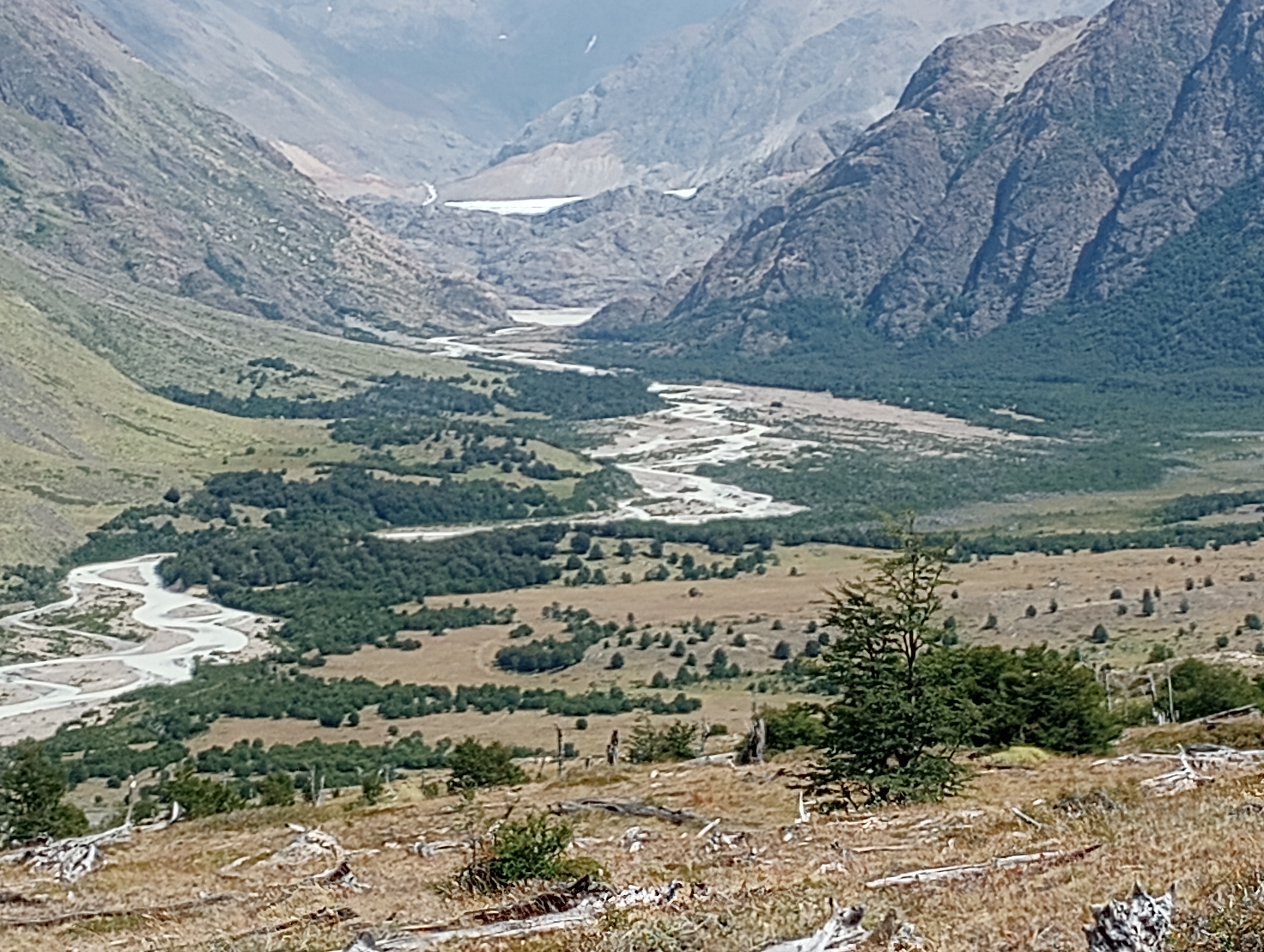
After a short period of fairly easy sailing, I reached a split in the trail, with one branch seeming to go downhill, and the other staying fairly level. I first decided to try the level trail, but turned back when it deteriorated to the level of being difficult to find/follow. I turned back, and tried the lower trail, but it seemed to be in similar condition. I paused to decide what to do, close to turning back, but I decided to try the upper trail one more time. This time I made it to the second rocky ridge, which was much easier to cross, and reconnected with the lower trail on a small connector. The lower trail seemed much more dominant after this ridge, so I took it towards Perolniyoq, the ruins above Soqma. As I approached slowly, picking my way through thorny brush, a (the?) worker at the ruins spotted me, and seemed to me hanging around where my trail would come out, and I began to worry that maybe I wasn’t allowed to be on this trail, or there would be problems with entering the ruins from behind. When I finally arrived, my doubts were proven false, as he was super friendly, and told me the directions I would need to go to take the trail, as well as that there was a group ahead of me that was doing the loop over a few days, so I might run into them (I’m pretty sure that the tourist trips start in Soqma, doing a slightly shorter loop). I thanked him, and continued on, enjoying my moment of flat ground before I would continue uphill. The next section of climb started tame at first, but soon got steeper. Right before it got steeper I stopped to take a break and check my map. I figured out I had about a mile and a half more of steep uphill, with over 1,000 ft of elevation gain, but then I would be on mostly rolling flat and downhill for the rest of the hike.

Looking back towards Perolniyoq, on the flatter section

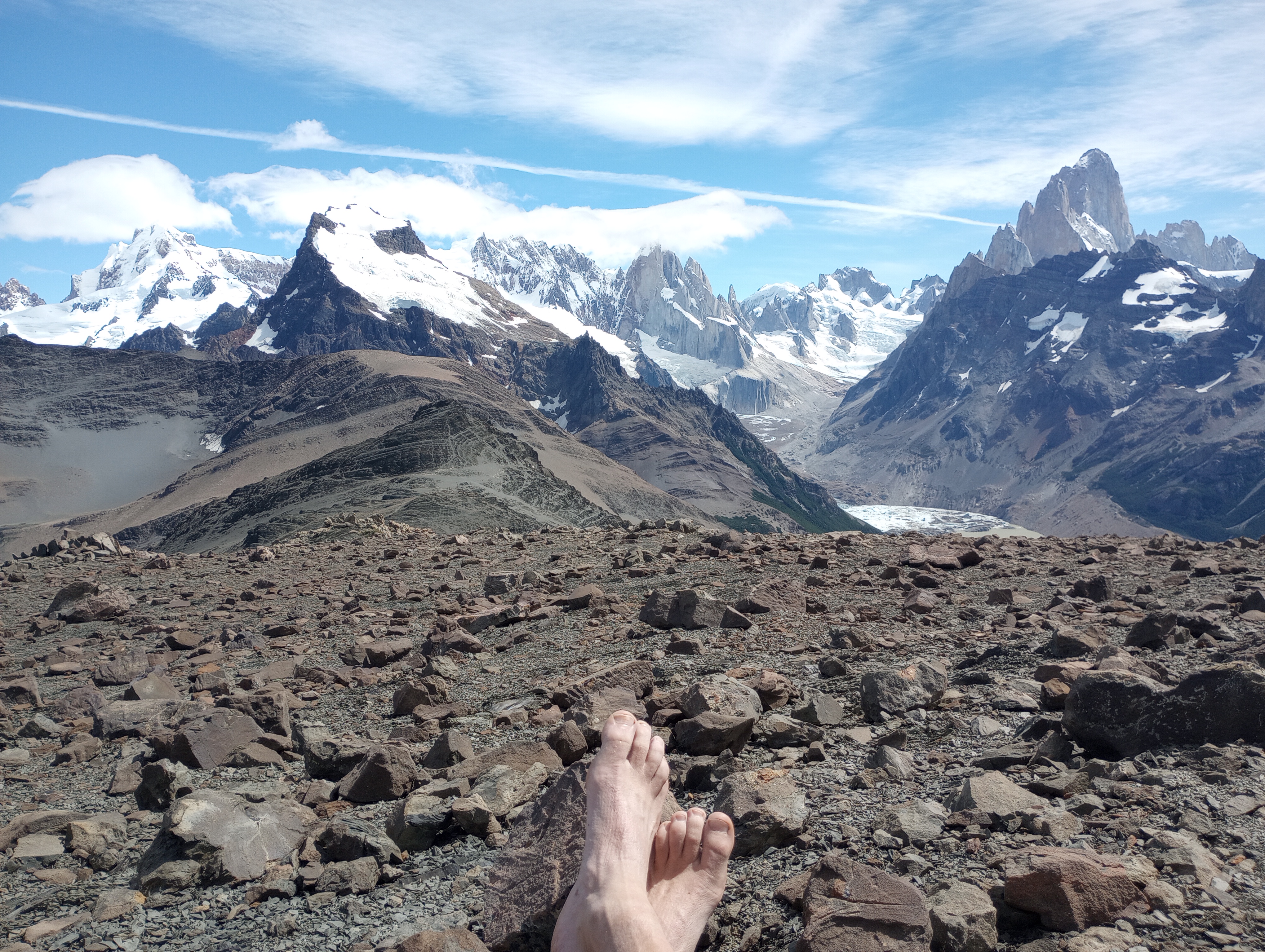
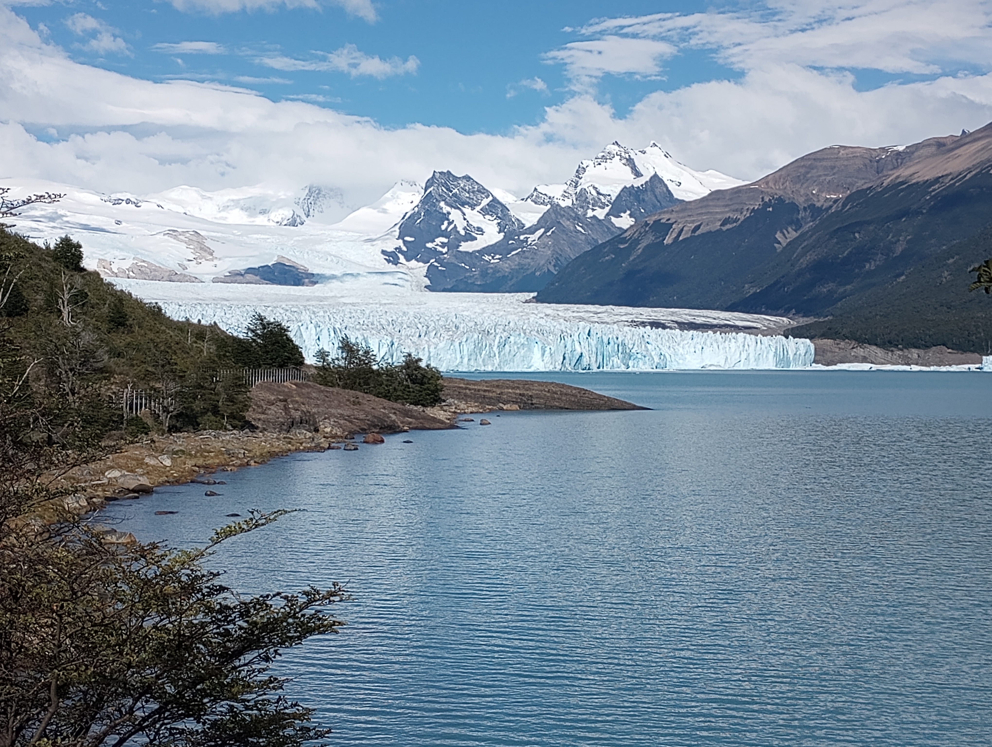
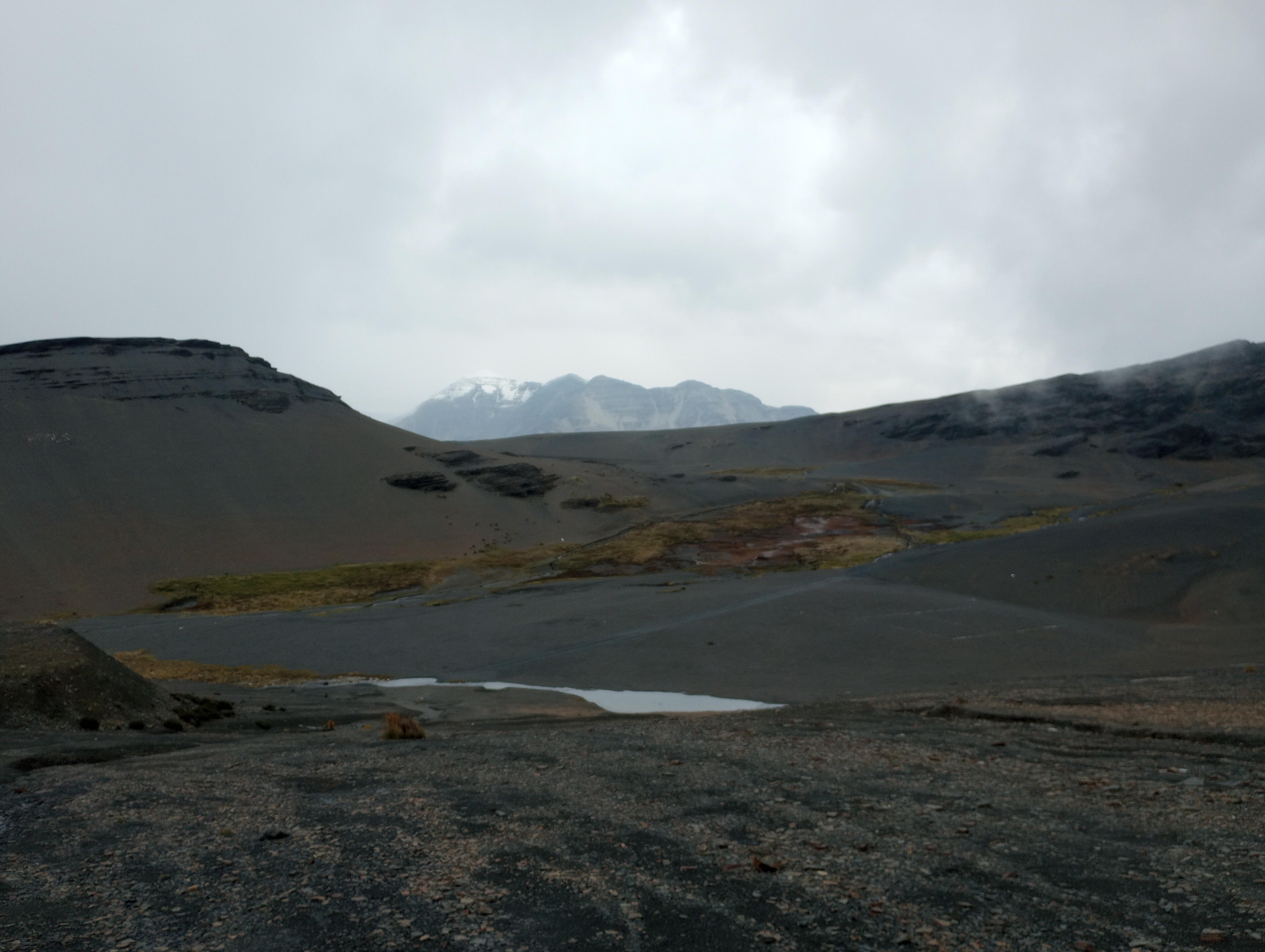
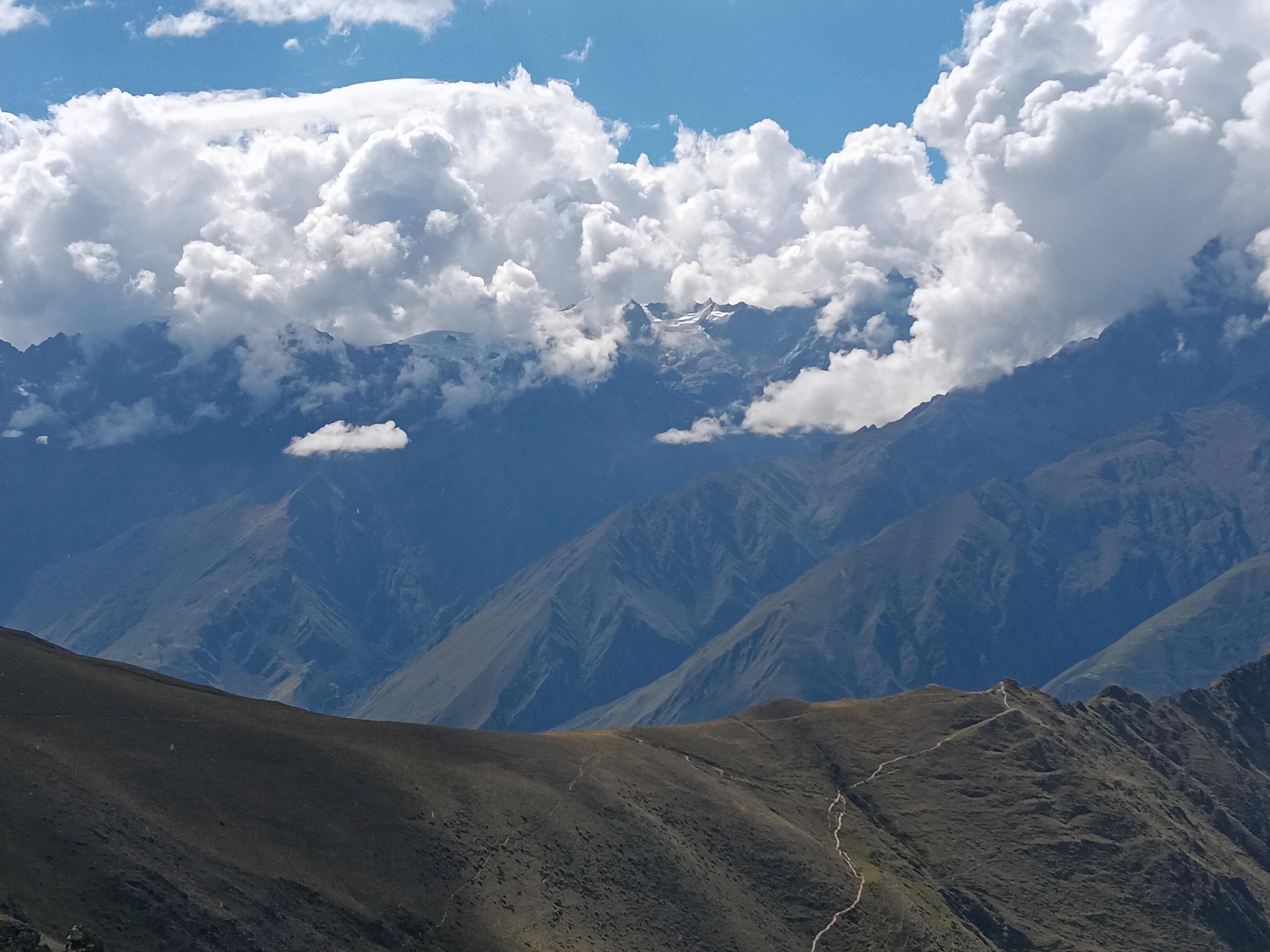
Already at 13,200 feet, the altitude was affecting me, but I decided I wouldn’t take a sit-down break until I was at the top. A mile later, I broke this promise, plopping down for a drink of water and a snack. I checked my map again, and was less than a half mile away from the top, and made another promise to not stop till I reached the top. This was broken a quarter mile later, when I sat again for more water and to catch my breath. This last half mile from the first break to the top may have been the single hardest half mile I have ever hiked– not purely from the steepness of the trail, but also because of the altitude, and having already climbed over 5,000 feet. When I finally reached the top, a magnificent view of the glacier topped mountains came into view, and I was very happy and relieved. My turnaround time was 12:00 noon, and at that time I was taking my last break before the top, but I decided that the descent on more traveled trails would likely be much faster, so I could push that back a little. I reached the top at 12:15, and after a brief pause to take in the view, started quickly descending the trail on the other side.

Finally on top, looking back towards where I came from

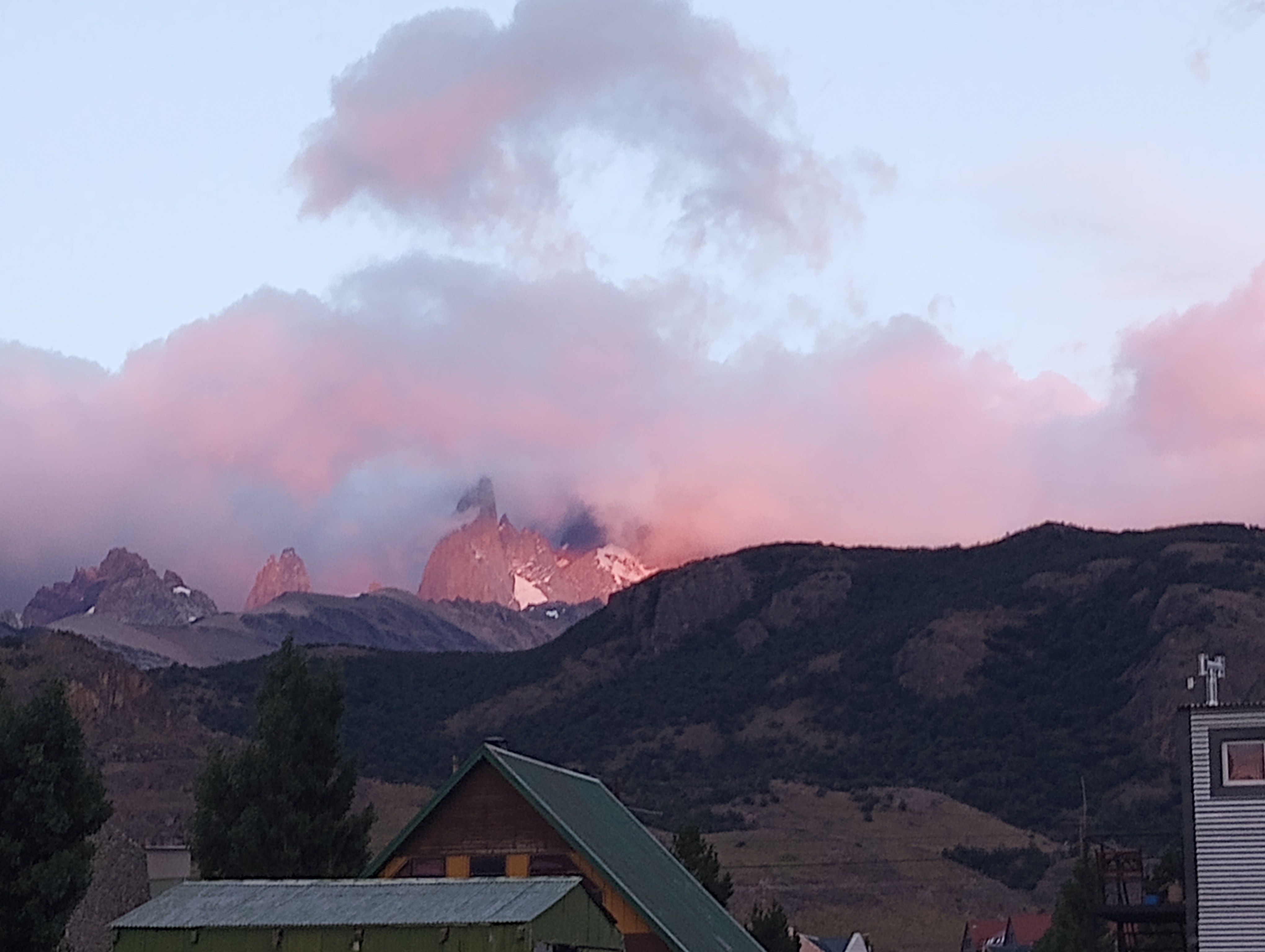
Due in part to looking at the mountains, and also being relieved and excited, I wasn’t paying too much attention to the wide grassy trail. Less than five minutes after crossing the pass, I rolled my ankle and fell, staying down for a couple of minutes to make sure I was alright. I ate a hard-boiled egg, and then kept going, still quickly but more carefully. I soon got a glimpse of Ollanta, and even our rental property far far below, as the trail started crossing the valley side of the ridge. The trail eventually switched to the other side of the ridge, providing stunning views of large red rock mountains/formations, which my crappy phone camera failed to capture wholly. The trail was rolling, but the hills were short and gentle, so I made good time through this section– until it sharply turned uphill. Though the hill wasn’t too long or steep, it was very slow and tough, both with the high altitude and the fairly shot leg muscles. I decided however to do an extra 100 meters of gentle climb to reach the top of Yana Urqu, a large rock formation/mountain that towers above the sacred valley and the Intipunku (the second destination on my loop).

The view of Ollanta from above
The path that I would soon be descending down
The Intipunku is where the trails meet, on the ridge.

After taking a break up top, I started my descent, which started with many switchbacks on a scree-filled trail. It may be less, but it felt like at least 50 short switchbacks. As I descended, a cloud came overhead, and started spitting rain and sleet, but I didn’t stop for a raincoat, anticipating the storm to be short and not wanting to get caught on the switchbacks if the ground got muddy and even more slippery. At this point I could see the group that the guard at the Soqma ruins had mentioned in the distance. As I finally approached the Intipunku, a rainbow appeared below and to my right, almost like a celebration of me having made it. I caught the other group at the Intipunku, and talked some, as well as taking their picture before moving on. There were two guides from Cusco, and the foreigners were from North Carolina, Tennessee, and I never heard where the third guy was from.

The view of Ollanta from the Intipunku
The Intipunku itself

Going downhill was nice, and I was going pretty quickly, happy to be in familiar territory and definitely smelling the barn. Every uphill, or even extended flat section was very tough, killing momentum and making me want to stop, but I pressed on, wanting to be home. Re-entering town on foot, there is a series of 3 switchbacks to get you up from the bridge to the level of the town. These aren’t steep, or long, and I never considered them even an inconvenience before, but they were so very long and difficult, and I had to work hard to resist the urge to sit on one of the benches at the top.The gentle uphill of town was slow, but made easier by knowing I would very soon be back home. I finally arrived home a little before 5, almost 11 hours after I had left. In all, I did over 6,700 feet of elevation gain, and 22.7 miles. I arrived home thoroughly tired and achy. I can definitely say that this was the most physically challenging hike I’ve done so far, and I don’t know when the last time I was this tired was.

Categories: Uncategorized | Leave a comment

More El ChaltĂ©n (or Awe, Part 2B)

I wrote about our first few days in El Chaltén in the last post. Because there are so many photos, here are the rest, from three long solo hike/runs, each longer than the last.

February 11: The Triangle. 13.8 miles, 2060 ft vert., solo. NW on the Fitzroy trail, then south past Laguna Madre and Laguna Hija, then back to town on the Laguna Torre trail. I ran a lot of this one, when the trail and the crowds let me. The triangle is just two of the well-known hikes done partway and connected by a much less-travelled trail past some lakes and through more woods.

Looking back at El Chaltén from the north

And looking north up the Rio de las Vueltas

Up from Laguna Madre

February 12: Laguna de los Tres. 16.2 miles, 3680 ft vert., solo. This is one of the marquee hikes at the park, and the most crowded trail I was on. Though I was mostly hiking, often I would have to pick my moments to run to get past big groups of slower walkers. And at the top, a long steep rocky trail – kind of like a steep narrow stairway with hundreds of people going up and hundreds more coming down, all at varying levels of speed and agility. But the lake itself, and the scenery all around, make it worth it.

Laguna Sucia – Zeke was down there on that same day

This fox seemed interested in people’s backpacks, and for good reason

The start of the long conga line down

February 13: Laguna Toro. 21.8 miles, 4600 ft vert., solo and running lots of it. This is the hike Zeke did on the first day, with a few extra explorations. I went out on this hike without any expectation of getting to the lake, but the magnetic pull of the destination kept me going. Once over the shoulder of a minor mountain, the view up the valley to the glacier above the lake was amazing. I have this theory right now that the way we, 21st century human beings, express awe and wonder is to pull out our phone and try to capture it somehow. So yes, there are some good photos here, but I want to say that they don’t (and wouldn’t, even if I were a better photographer) capture the sense of being and moving around IN this landscape rather than merely looking at it.

The woods, sometimes with wild cows

Looking back toward town

Looking up the Laguna Toro, the second-to-last white thing in the valley. Behind it is the glacier that feeds it.

How to show how windy it was? Well, you could show waves breaking on this small lake.

Or you could show a thick beard blown sideways…

And those are the hikes. We enjoyed time in a hostel again, even if we had some conflicts in sharing a room between the three of us. We got a reasonable amount of home-school calculus done, but for Zeke I’m sure that the bigger learning right now is her learning to test her limits out on the trail while making good decisions and being safe. She’s delighted at her extended range; we’re delighted that we feel we can trust her to be wise.

It should be said that El Chaltén, beautiful as it is, is definitely a tourist town. Restaurants and hotels are expensive. A hostel where you can cook your own meals is a way to save money. Camping is another way to save money. But the wind blows hard several hours a day and sometimes all night. One of my strongest memories of El Chaltén is the wind, whipping and whistling around the windows of the hostel at night. And I was thankful to be inside.

Categories: Uncategorized | Leave a comment

El ChaltĂ©n (or Awe, Part Two)

We spent a week in El ChaltĂ©n, about a three hour bus ride from El Calafate – that is, way down south in Argentina hiding in the shadow of the Andes and the Chilean border. The appeal of El ChaltĂ©n is largely the iconic Fitzroy mountain range, which is right there to the west of town, when the sky is clear. It often isn’t, and on a cloudy day, you might never know there’s much over there … not even Chile.

We came here on the recommendation of Leticia’s parents. Unlike in much of Patagonia, not having a car isn’t much of a disadvantage. There are lots of day hikes that all start just outside El ChaltĂ©n, many of them about 15 miles long. Any one of these hikes would be enough for a post filled with ridiculous scenery, and I/we did six of them in seven days.

Here’s a fascinating bit of history: Argentina and Chile still do not have a settled boundary. In the late 1800s, the boundary was set along the Andes as being marked by the line of highest peaks and depending on the watershed (Pacific to Chile, Atlantic to Argentina). But the heights of the peaks weren’t known for a long time, and watersheds are even more complicated. I read somewhere that an American survey plane flying over in the 1940s found that Lago del Desierto, just north of El ChaltĂ©n, by the watershed rule should belong to Argentina rather than Chile (as previously believed). This became a minor skirmish that resulted in the death of one Chilean soldier in 1965. Arguments back and forth continued for decades. This was all finally (sort of) resolved in 1998, except for a bit almost completely covered by ice just north of El ChaltĂ©n that still shows up on lots of maps as a rectangle in which the boundary is unresolved. El ChaltĂ©n itself was founded in the early 1980s in part to establish an Argentine presence close to the border. Because of the part in the treaty about the highest peaks, there’s a skinny little piece of Chile that sticks out to the east to reach the top of Mount Fitzroy, only about 6 miles west of El ChaltĂ©n.

(Side note: going to school in Bolivia seven years ago, Anna and Zeke learned (and sang about) the land that Bolivia lost to Chile in the 1880s, making Bolivia land-locked, something Bolivians still lament. Only recently I learned that Chile gave up the eastern part of Tierra del Fuego to Argentina during that time because they had their hands full in the north. Of course – of course! – the maps at the time weren’t complete, and in 1978, Argentina and Chile almost went to war over three islands south of the big island of Tierra del Fuego. OK, digression over.)

We found a nice rhythm during this week. We all have our own hiking (and often, in my case, running) styles, and so we did some things together and some things all on our own. We often did the same hike, but on different days, and then either told each other things to look for or waited til after to share notes. All of these took place largely inside the Parque Nacional Los Glaciares. We were inside the southern part of the park when we went to the Perito Moreno Glacier a few days earlier, and we had to pay. This part, though, was free to everyone, which is great, but on the other hand, we foreigners could pay something to enjoy this amazing place.

Anyway, here are some notes:

February 7: Miradores and Park Office. 4.3 miles, 980 feet vertical gain, all together. South of town to the park office, and then out on trails to Mirador los Condores and then Mirador los Aguilas. Great views of town to the north and Lago Viedma to the south, as well as – as always – the mountains to the west.

February 8: Chorrillo del Salto. 6.5 miles, 740 feet vertical gain, solo. I went to bed the night before with a stuffy nose, cough, and sore throat, and for some time in the night I was awake with a nasty headache. Zeke went through a similar thing a day earlier. I woke up still in bad shape, and we had already planned to be on our own today. Zeke got out fairly early, and Leticia stayed around a little while, getting me set up with vitamins and tea. I slept until noon, ate a little, felt somewhat better, and went off exploring town and eventually this fairly easy hike north of town to a waterfall. Leticia came back in the afternoon tired but happy, having gone 15 miles; Zeke showed up at 6pm, full of adrenaline, having gone over 20 miles out to Laguna Toro with a side trip or two. She called it one of the best hikes of her life.

February 9: Laguna Torre. 14.8 miles, 2300 ft vertical gain, solo. Zeke and Leticia were both ready for easier days after their big walks, and I was ready to get out in the mountains. So I did the Laguna Torre hike, which Leticia had done the day before. The pattern many of these hikes follow is through woods and up valleys to glacial lakes, with better views of the big mountains around every corner. It ended with a slow walk around the rim of Laguna Torre (so named because it sits at the foot of Cerro Torre) to a lookout, where you can see the glacier come down into the lake.

February 10: Loma del Pliegue Tumbado. 13 miles, 4080 ft vertical gain (max altitude 4967), all three of us. The name means “Hill of the Lying Fold”, referring to the geology of strata actually folding over on top of itself. Another amazing hike up through woods and eventually out onto a clear rocky area, with a steep half mile up what seemed like a black rockpile to get to the top.

There’s so much more! I’ll put the last three days in another post.

Categories: Uncategorized | 2 Comments

Glaciar Perito Moreno (or Awe, Part 1)

How often do we experience awe? I can think of a few times in my life: playing in ocean waves for the first time, not getting tired of hours and hours of being whirled around by forces so much bigger than me; seeing the Rocky Mountains for the first time; the Grand Canyon; the Andes, and the amazing things humans have built there, like Machu Picchu and the city of La Paz.

To these I have to add a completely new experience: glaciers, with icebergs. It’s a little like going to the Grand Canyon, if pieces of the canyon wall fell off every few minutes.

Sixteen years ago, we had dreams of going to Patagonia, but Zeke was 1, and didn’t enjoy hours or days on busses. We didn’t really have the dough to fly south, and, not to keep blaming Zeke, but our flight to Argentina with her was enough to make us want to stay off a plane for as long as possible. But she’s 17 now, and we have more money than back then, and so we bought tickets from CĂłrdoba to El Calafate, in Santa Cruz province. (If you look at a map of Argentina, it’s pretty far down there.)

Perito Moreno glacier is one of a few in the world that isn’t shrinking; in general, it advances 2 meters a day. In the summer, at least, it falls apart at about the same rate, sometimes in big parts calving off the front. You can watch plenty of “glacier calving” videos on YouTube, and they’re pretty cool. But: it’s a different thing when you hear a noise that sounds like thunder, and you see what looks like a little snowball rolling down the front of the glacier, and the splash it makes tells you that that was actually a pretty big thing.

The icebergs in front are exciting, too – occasionally a piece will break off, which unbalances them, and they roll over, revealing a crystal blue underside that changes color within a few minutes.

Perito Moreno is also fascinating because it’s advancing into two arms of Lago Argentino. The land that faces them has lake to the south, lake to the north, and the glacier to the west. When the glacier reaches that land, it backs up the lake to the south – there’s a bathtub ring that shows the high-water mark. Eventually the pressure builds up, and the water starts to undercut the glacier, making a tunnel (or bridge). And eventually that collapses, sending huge waves across both parts of the lake (look up “Perito Moreno bridge collapse” to see one of those).

That happens every 5-10 years, and we aren’t at that point in the cycle. The land that faces the glacier has metal walkways all over it; you can watch from up high, down low, to the left, to the right, closer, farther. It may be hard to believe that standing in the same place watching the glacier for an hour or more remains fascinating, but it does. There are thunderous crashes from inside the glacier, pings and gunshot sounds as bits of ice shift, and the occasional calving event. There are pieces that fall off the face out of sight, but you hear it, and then you see the waves in the lake.

And this ice cave, 60 or 70 feet across, whose ceiling was gradually caving in, disgorging these floaty bits.

The face is about 220 feet high at its peaks. We were lucky enough to see a big piece (a “shard” 100 feet high and about 30 feet across) fall in late in the afternoon.

Cerro Perito Moreno, just south of the glacier.

Condor!

It’s about three miles across.

We left after about 4 hours at the glacier – we would have stayed longer, but the bus that took us there was going back. El Calafate, the nearest town, is really really touristy, and everything is more expensive. But it’s still fun, because WE’RE IN PATAGONIA! Leticia was made really happy by two guys sitting by their truck with a small sign: cherries for sale from Los Antiguos. She talked to these guys for a while; they had never done this before, but decided to drive from Los Antiguos, a town about 500 miles to the north (but still in Patagonia) with a truckload of cherries to try to sell them. It turns out cherries from Los Antiguos are kind of a thing; we saw a few others selling them too, both there and later in Rio Gallegos.

We’re at 50 degrees south latitude; it’s light until about 10 o’clock at night. From here we’re headed north to El ChaltĂ©n – prepare yourselves for more ridiculous pictures of mountains, glaciers, and lakes. And then farther south, eventually to Ushuaia.

Categories: Uncategorized | 2 Comments

La Cumbrecita

With time in La Falda ending and our flight south still a week away, we found ourselves looking for somewhere nearby to go for a few days. Leticia’s cousin Daniela suggested La Cumbrecita, southwest of CĂłrdoba. It was a good suggestion.

La Cumbrecita is a pedestrian town; you have to park your car at the edge and walk in, or if you live in town, you have to wait until evening to bring your car in. It’s about 1000 feet higher than La Falda, lucky for us since we happened to be there during a really hot week at the lower altitudes. The main attractions are all the rivers and creeks that run through and near town. Most people don’t have air conditioning, so there’s a culture of spending hot days by the side of a river, drinking mate, snacking, and occasionally getting in.

There are lots of places around La Cumbrecita to do this; here’s one, the Cascada Grande. Tons of people here, but just below, down a steep rock climb (made possible by two iron rungs in the rock, and made possible for me with Zeke’s example and help), we had a smaller pool all to ourselves.

(Zeke heading back up.)

There are plenty of mountains to go up as well; the mountains have the smooth rounded rocks similar to those we saw in Characato. Here’s the top of Cerro Wank, 5500 feet high and about 1000 feet above town. That’s town in the distance. It’s small and hidden in the trees enough that it doesn’t stand out.

We rented a great apartment on the top floor of a house about 2 miles outside town. (One mile as the crow flies, but you have to go down to a river and back up the other side, or else the long way around that valley.) We could have called a taxi, but the folks who rented the place to us were kind enough to drive us from the center of town to the house on the day we got there (with all our stuff) and kind enough to do the opposite at the end (again, with all our stuff), and give us one more ride on another day they happened to be out there. Barring that, we always walked. The walk was enjoyable, partly shaded, and graced by blackberries just coming into season. There was also a nearby beach on a creek about 10 minutes downhill from the house.

(La Ponderosa, the house where we rented an apartment, on the top floor.) There was good entertainment just sitting on the porch looking across the valley as the clouds moved across the mountains.

La Cumbrecita has a Swiss-German thing going on – it was founded by Germans in the 1930s and 40s – and this means that lots of different places have their own craft beer. And it’s pretty good – that’s one of the great differences and improvements from our time in Argentina in 2007-2008 – so many more, and better, beer choices. It’s a little thing, but it makes a difference.

(Pampas fox, seen from the balcony of the house.)

Cat at the bus station. Bus to Villa General Belgrano, then another on to Alta Gracia. The following day another bus back to CĂłrdoba, a taxi to the airport, and a plane to El Calafate, in Patagonia. It’s about to get epic!

Categories: Uncategorized | Leave a comment

Characato

Characato lies about 20 miles west of La Falda along a dirt road. If you keep looking west, it’s more than 30 miles to the next paved road. You have to go even farther north and south to find pavement. (OK, this isn’t actually true. There are little parts of the roads that have creeks going over/under them; these are paved so they won’t wash out.)

There are, we’re told, about 70 houses in Characato, but only about 20 year-round residents. The rest are owned by folks who come out on weekends, or for a few weeks in the summer. In short, Characato feels miles from everywhere, and there’s hardly anyone there. So why did we go?

Well, there’s a lovely little hostel there. And there are mountains to hike into or just watch the clouds move across. And fun rocks of many shapes, and creeks that pass through them, making waterfalls and swimming holes. And sometimes being far away from lots of things, like light and noise pollution, is enough. Sebastian, who owns the place, says, “it’s like being in another century.”

Nine of us went: me & Leticia, Anna, Zeke, and Makail, Leon & Louisa, and Leticia’s cousin Felipe and his partner Meli. Felt & Meli’s truck only held 4 or 5, so 5 of us walked out, taking advantage of the truck to schlep much of our stuff. We set off at 7am, hoping to get a few miles in before the heat of the day kicked in.

If you want to know how far things are, it’s better to travel by land – that was the idea behind our 2012 bus odyssey around South America. It’s even better to travel by foot, and so we headed west out of La Falda on roads that became dirt roads, then became paths that you could get a 4-wheel drive on, then became single-track, then became bushwhacking toward a road we knew was nearby. We were lucky in that the sun never really came out; the day stayed overcast and relatively cool all day.

We stopped a few times for to eat and drink, and about halfway in Felipe, Mel, Leon and Louisa passed us in the truck, giving us mate and facturas. We had left the gradually rolling pampa and crested a ridge that now looked into mountains of rounded soft-looking rocks and patchy greenery. We lived in La Falda for a year and never knew this was here, I thought.

Time passed, and miles passed, and feet got sore, but eventually we could see what must be Characato…several miles away in the valley below. But eventually we were met by Louisa and a few of the very friendly hostel dogs and walked the last few miles in. There are zero restaurants in Characato, and one dispensa (that’s like a little tiny general store) that’s open sometimes. But they made excellent supper for us at the hostel, and we slept well with 23 miles in the books for the day.

The next day we were up before breakfast and 7 of us walked up the mountain that faces the hostel. Tricky finding our way at times; one of the directions was “the hostel dogs will guide you”, but we got out the door before they were awake. (Zeke, Anna, and Makail did it a few days later, and said that the dogs were, in fact, good guides.)

(That’s Zeke up there.)

What else did we do in three days in Characato? Well, there are lots of directions to walk, with creeks and waterfalls to dip in, mountains to climb, views to enjoy. La Falda is not a metropolis, but it feels like it compared to Characato – you can relax here in a way it just doesn’t seem possible in a place with traffic and stoplights and music playing. The stars in Characato were amazing, too, on clear nights. We fantasized about renting or owning a house out here – they say for about $30K you can buy something small, and lots of the houses are places where people have done just that, and come out on weekends or for a few weeks in the summer. But to live here a full year, among the 20 or so full-time inhabitants…that would be something to experience.

There is one road that goes by Characato, which is actually on a dead-end spur of that road. The road is mostly dirt, except when it crosses a river where the usual thing is a vado – a low river crossing with some drainage for the river to pass underneath, but with the expectation that in high water the river will go over the road. On a run one day I came to this scene, after some rain the night before. And an older Argentine couple who had planned to drive a big loop, but hit this about 26 miles from La Falda. A local had told them it might be passable in half an hour; talking with others later that day, I learned that hours later it still wasn’t. They must’ve gone all the way back to La Falda the way they came, or perhaps taken an intermediate road about 15 miles back that may or may not have the same problem. What a delight, I thought, to be in a place where the weather – in this case, a not-so-huge rain – dictates your way out of town.

Felipe and Mel had to leave after two days, and on the third we hired a truck to take us back to La Falda. But there were 7 of us, so Zeke walked the 23 miles, I ran them, and Louisa and Leticia did a relay, each walking about half and taking a ride the rest of the way. We had the truck to carry our stuff, so it was fun and pretty easy – for me the hardest part was getting the last hostel dog to not follow me back to La Falda.

A final thank you to Pablo and Erica, employees of the hostel, who hosted and fed us and answered tons of questions and generally made the place feel relaxing and welcoming. Will I ever be back here? I hope so.

Categories: Uncategorized | Leave a comment

Last days in La Paz

It was a whirlwind, that last week in La Paz. I had imagined that I might get away for some solo adventures, the kind of thing I had imagined doing on some free day – running up Chacaltaya, the world’s highest abandoned ski slope, or paying to go with a group up Pico Austria, or a long exploration out one of the valleys that leads out of the city, or a solo attempt at the La Paz marathon course. But things kept coming up – one chance to do this, one last chance to eat with these folks, one more chance to hang out with this group of people, a chance to do this thing that I had talked about with these friends…and the individual things got nudged aside.

Which is, in retrospect, as it should have been. La Paz will be there the next time I am ready to go, but these constellations of friends…who knows? Things change, people move, people change, groups coalesce and disperse. One lesson from living in hostels in 2012 and 2017 is that communities do this, and sometimes there’s magic in a group of people that is together for a few days. And you can’t try to hang on to it or prolong it – part of the magic is its transience.

This wasn’t quite like that, but I knew from the start that, for better or worse, this time would only last a little more than four months. If you’re an old friend (or a family member), you know that I’m not very good, or perhaps not very dedicated, at keeping in touch over distance. So while there certainly are friends I’ll keep in touch with, it isn’t the same as being together in person, and that’s often too big a hurdle for me to get over.

I’ve got 4 months of photos that I could include here, but I’ll just pick a few:

The whiteboard on my last day of classes.

My dresser, with all numbers from the races I ran this semester.

A few of the first people I ran with with the 300 Runner Team, now part of the 6AM club.

Huayna Potosi, taken during my last trip up to El Alto.

Illimani, taken from the hallway outside our apartment.

And one more thank you to Elvis Valero, who offered a room in his apartment to a complete stranger, and ended up being my best friend during these months, as well as my connection to a social life I wouldn’t have had otherwise. Did you know I was out at a discoteca? After midnight? Can I tell you the last time this happened? No, I cannot. I can only say that the year started with a 1.

Gracias, Elvis. This time would have looked very different without you.

And here’s one more thing we did: on my last day in La Paz, me, Elvis, and our friend MaJo Ponce rode the teleferico and recorded me playing Teleferico, a song I wrote in 2016. I’ve been thinking of a video of this, done on the teleferico, ever since. Elvis made all of the logistical stuff happen. MaJo took the video and did the editing and the special effects. I’m delighted with the result.

Categories: Uncategorized | Leave a comment

La Falda, once again

There is more, much more, to say about my time in La Paz. The last few days were a whirlwind of packing (thankfully, not a tremendous amount of stuff), logistics to wrap up, and so many goodbyes.

Three weeks later, it already feels like so long ago, and there is a lot of sadness in that. The trade, though, is worth it – Leticia, Anna, Zeke, and me in the same place for the first time in six months. 2023 was our most separated year ever, with Anna in school (and at work) in Vermont and working a summer job in Virginia, with Zeke in Costa Rica until June, and then me leaving for Bolivia in late July. I count 4 days in which we were all together – two in January, one in June, and December 31, when Anna and her partner Makail got to La Falda, Argentina.

If you know your Weber-Loomis history, you may know that we lived here during our first sabbatical year in 2007-2008, in the house shown above. Anna went to kindergarten here. Zeke learned to walk here. Along with Leon and Louisa, Leticia’s folks, we’re renting a house three doors away, next to Leticia’s aunt, uncle, and cousin, across town from another cousin – the same connections that brought us here 16 years ago.

So La Falda doesn’t feel foreign at all; like La Paz, it feels enjoyably familiar. Unlike La Paz, it’s small; we’ve definitely walked over half the streets here, and Leticia (and Zeke, if you count being pushed in a stroller) has done the vast majority of them.

The Banderita, the mountain above La Falda, is the hill we’ve climbed as a family more than any other. It’s 4700 feet high, about 1600 feet higher than this house. It’s a 3-4 hour round trip from our neighborhood. We’ve been up twice, I’ve been up once alone, and Zeke twice on her own.

Two days ago all seven of us went up, and then went down three different ways – Anna, Makail, Leon, and Louisa on the normal route, Zeke on a long, rambling exploration to the east, and Leticia and me on a new route to the northwest. We are well-matched on adventures like this: I have more endurance than she does, but she’s more comfortable with heights and steep slopes. In the end we got ourselves home together, 4.5 hours and 7.5 miles after leaving.

Above all, I can’t overstate the contentment I feel having us all here together. My Mom says “It always feels good to have all the horses in the barn.” And while La Falda is special to us, that’s icing on the cake. On some level, it doesn’t really matter where the barn is; it’s who’s there that counts.

Categories: Uncategorized | Leave a comment

Up to La Cumbre

My time in La Paz is growing short. These are sweet days; (almost) all the paperwork and bureaucracy are behind me, all the stomach and health problems seem to be behind me, and folks are beginning to say that they’ll miss me and they hope I’ll come back sometime. I’m no longer thinking about maintaining a regular routine; instead I’m thinking about all the things I still want to do and which of them I will actually get done.

One of those things? Getting out of the city and into the mountains, and so on a Tuesday (with classes Monday and Wednesday), I decided to head up to La Cumbre, to an area also known as La Rinconada.

La Cumbre is the mountain pass to the east of La Paz. I remember going over it in 2016 when we went to Coroico and, later, Chulumani. If you want to go to the South Yungas, this is the road you take. It rises up to 14,600 feet before plummeting down to about 4,000 in the Yungas valley. And, as it is a pass, there are higher mountains around it. And so I got a minivan to Villa Fatima, walked a little to the Minasa terminal, wandered around a bit, and found a Chulumani-bound bus that was almost full with its engine running. (Here’s a thing that happens: someone sells you a ticket for a van or bus that’s leaving “right now”, but then they wait around for as much as an hour trying to fill the vehicle with passengers.

This bus was full, but they said I could take it to La Cumbre. I didn’t have a seat, but it was only half an hour, and would have been less if half the bus hadn’t disembarked at a tollbooth to buy food. But a ways up the road, I started to make my way to the front of the bus. This was the kind of bus where the driver is below, and you have to bang on the door to get their attention. A few were saying that we had already passed La Cumbre; “¡Golpe la puerta! ¡Golpe la puerta!” they were saying. Others said that we still had a little ways to go: “¡Falta! ¡TodavĂ­a falta!” By now it was raining hard outside – I remembered our 2016 trip, in which it seemed sunny and pleasant on either side of the pass but cold and rainy – even snowy – at the top. A few old men tried to dissuade me: “Why are you getting off here! There’s nothing here! It’s cold! It’s raining!” But I assured them I had more clothes in my backpack and that I wanted to walk around in the cold rain. And the driver’s assistant remembered my request, we stopped at the right place, and I bid farewell and thank you to the front half of the bus.

Well, the old man who said “No hay nada acá” was mostly right. A big statue of Jesus overlooking the pass, a sign for the national park, a building that looked a little like a park office, a fenced in area with a few cars, a dog that came over to see if I had any food to offer.

This is the beginning of the Camino El Choro, which goes about 2 miles up to a higher pass and then plunges (more steeply than the road) down about 11,000 feet over the next 40 miles or so, going from high altiplano to thick jungle. I had class the next day, so I just wanted to go to the top, peek over the other side, and come back down, with a possible alternate way back to La Paz.

It wasn’t raining now, but the skies were gray, and there was thunder to the north and occasional thunder and lightning to the west. No real signage, but I had studied maps and knew what gap in the ridge I needed to head towards, so I picked the roads that seemed to do that.

These pictures look pretty gray, but there was a surprising amount of greenery about, mostly the grasses and bushes typical to the altiplano.

And several lakes, and, as I got higher up and when the wind blew just right, an opening in the clouds, giving a view of a side of Huayna Potosi that I don’t normally see. To the south I caught a glimpse of snow where Illimani should be – that would be an amazing view on a clear day.

I continued on, and the rain started again, and as I got higher it turned to freezing rain. I had stupidly forgotten to pack my plastic poncho – I had been caught in the rain exactly once in 4 months in La Paz – and I was starting to get genuinely wet.

Up at the pass – the Abra Chucura – I hit 15,965 feet, the highest I’ve been on this trip. Going up, walking quickly, I was breathing hard and could tell I was at altitude, but I could also feel the benefits of four months of running at 10 to 12 thousand feet. My wish to see down into the valley was not to be granted; mostly I saw a gravel road that seems to drop off into thin misty air.

I did have some hopes of going down a little to see if I could get below the clouds, but the thunder was continuing and I didn’t want to get caught on the wrong side of the pass. So I headed back down, skirting some lakes, one where some seagulls seemed to be protecting a nest. Seagulls! At 15000 feet!

By now it was snowing, which was good because it dampened me less. My idea had been to take another road – Highway 41 on the map – back toward the city through a different valley, going in front of Chacaltaya (which was once the highest ski slope in the world until, famously, the glacier melted) and coming out in El Alto, in a completely different part of the city. But I was wet and that could have meant another 10 miles of walking, so I came out on 41 and turned left toward Highway 3, the one I had come up.

I only had to wait about 10 minutes back at La Rinconada before a shared taxi stopped for me. The way down was adventurous too. If you’ve been hiking in the mountains, you know you probably should be prepared for rain or snow or bright sunlight or all three. If you’ve been driving in the mountains, you know the conditions can quickly turn from fine to really dangerous (OK, also true if you’re hiking). Going past this snowy mountain, we passed a recent head-on collision in the other lane, and a few hundred yards later, a minivan on its side in the ditch. It looked like just a small band of ice on the pass; a mile later the road was dry and the sun was shining.

Back in Villa Fatima, it felt summery and I walked on the sunny side of the street to dry myself. It was my good fortune to find a place for api and buñuelo just before the next episode of hard rain. All told, only about seven miles of walking, but it felt like an adventure. It’s one more amazing thing about La Paz – spending about $5 round trip on public transportation, you can find these adventures in almost any direction you go.

Categories: Uncategorized | Leave a comment

Tihuanacu Trail Race – 28km

I know I’ve written about running in Bolivia before, but here’s a race so epic that it gets its own report.

It’s the Tihuanacu Trail Race, with three distances available – 10k, 18k, and 28k. You can guess which one I chose. Tihuanacu is about two hours from La Paz, depending on traffic, and is the site of one of the most significant archaeological sites in Bolivia. My memory was that it’s pretty flat around there. Leticia’s memory was that there are some serious mountains nearby. We were both right.

The day started early – alarm set for 4:15, but I was awake at 3:50. I was out the door at 4:30 with two bean/cheese/avocado burritos and some cold coffee for the mile walk to the house of Cristian, a running friend who had offered to take people with him. If you don’t like traffic, 5:30 on a Sunday morning is a pretty good time, as long as you avoid the tons of trucks and people already setting up the Sunday market in El Alto. Sunday morning is also market day in the town of Tiwanaku, and the main square was ringed with stands selling food and household items, with the start/finish line on the west side of the square.

It’s a little reminiscent of 5k runs in northern Indiana 30 years ago, when the run would coincide with the town festival – the Greentown Glass Festival, Swayzee Days, the Peru Circus Festival, the Converse Fair – and you’d get the fun juxtaposition of out-of-town runners mixing with bemused locals setting up their stands. I found a place to go to the bathroom behind a building on the edge of town – very clearly not the first person to do so – and headed to the square. There was a ceremonial fire going right by the starting line, and, as often happens in Bolivia, the race started late, so I wandered around the square and bought a bag of water. The runners in their spandex were a sight for the locals, but I get the feeling I was even more an oddity.

(Here it is – the first photo I’ve ever taken during a race. During a moment of rest when I’d already climbed about 900 feet but had another 2000 to go.)

As we stood at the start line, the race director said just about the last thing I wanted to hear – “Be very careful on the downhill, because if you trip on a rock, no hay nada (there’s nothing).” I had looked at the course map and lots of satellite photos, and thought there wouldn’t be anything I couldn’t handle – but pictures from space never really give you the full story.

The 16 of us in the long race got going a little before 8am, out of town with a police truck ahead of us. We had traffic stopped for us as we crossed the highway and the road turned into a single-lane dirt road, heading straight for the mountains. There were water stops every 3-4 miles – the standard half-liter bag of water that you bite the corner off and drink from there. Around 4 miles my stomach was feeling unsure, and I detoured into a field and took bathroom break #2. This dropped me from 7th to 9th, but I was fine with that – I’d rather have people to follow. The road was straight and flat, and the first five runners were long gone. After about five miles we entered the foothills and the road started to bend and rise slowly, a good opportunity for bathroom break #3. (No worries finding a place to go once off the main road – there was lots of space and no people.)

(Partway up that first mountain, looking back the way we came.)

I went through 6 miles in 8:35 pace, which felt good, considering that included two bathroom stops, and that we were at 12600 feet and climbing. Shortly before the 7 mile mark, where I traded my empty water bag for a full one, the nature of the race changed drasticly. We were directed off the road and up a steep incline, where there wasn’t a path but a sequence of red police tape-type ribbons heading up the slope.

There were stiff grassy plants and lots of low thorny plants – as it got steeper and I used my hands, I had to take extra care where I put them. I stopped twice to take off shoes and socks and pull thorns – one even went through the sole of my shoe. I had passed someone shortly after we started up, and Cristian was ahead of me, but he was better in this landscape and that distance got wider and wider. Nelson, who I had talked to before the race (you see a lot of the same people race after race), caught me on the first small descent, but I caught back up to him on the next steep part, only to lose him when I had to take off my shoes and socks. He too was receding into the distance.

(Crossing a ridge and getting the first view of Lake Titicaca, about ten miles to the west.)

(Looking toward Kimsa Chata, the course high point. Note the red ribbon marking the course.)

Life got easier for a little while at times, like when the thorns thinned out and you could just run through the grass, but these miles were slow and difficult – mile 7, still mostly on the road, was in 17 minutes, and mile 8 in over 32. We had a little respite running along a ridge, but then the course went up again. I could see Cristian, Nelson, and a green shirt I thought might be Alfredo (another acquaintance from lots of races) spread across the slope ahead. And then Alfredo running along the top of the ridge, silhouetted against the sky. How narrow is that ridge? I wondered, hoping it wasn’t a knife edge with drop-offs on the other side.

(Have I mentioned that I grew up in Indiana, and that somewhere deep in my consciousness is the notion that the natural state of land is to be flat?)

I got to the water stop at the ridge just after two hours, and thankfully I could stay off the actual tip-top of the ridge, which had drop-offs to the left that ranged from not-bad to I-can’t-look. The views were, of course, amazing, but I had to focus on the ground under me – I was at 15200 feet, the highest I’ve been on this trip, and I was feeling clumsy and stumbly. This was Cerro Kimsa Chata – it’s sacred to the people in Tiwanaku, and one of the reasons there was a ceremonial fire at the beginning of the race was to ask for safe passage for all of us. I thought about this, and tried to think of the mountain as a benevolent spirit that didn’t want to see any harm come to me. And I said yo puedo, yo puedo, over and over.

The ridge section didn’t last long, and the worst part was not knowing what was ahead – would there be a really skinny exposed part of the ridge I had to cross, or a scary descent I would have to work hard to get myself down? Or worse, a moment when I would say I can’t do this and would have to drop out and find a different way back to town?

(It’s steeper than it looks.)

Just before we left the ridge, there was one more checkpoint, where the guy put a bracelet on me to prove that I had made it there. He told me there were no course markings, but he pointed out a house with three trees around it waaaaaaay down in the valley, and said I just needed to head directly for that.

(Blurry attempted zoom photo to help figure out the best way down.)

It was steep going down the mountain, but knowing I was off the high point was a relief. There were a few places where the land was convex and it wasn’t clear how quickly it would fall away. I did get to one precipice of 30 feet or more (maybe that was the place where no hay nada) but I managed to bear left and find a way around it. I could imagine a younger me bounding down this hill, but with my creaky legs, poor vision, and weak ankle (I had rolled it a few miles earlier) I eased my way down like an old man with a walker going down icy steps after church. I headed for a valley that looked like it would lead to the road below, but as I got farther down I lost the visibility I had from above.

I found myself in a grassy valley that got tighter and tighter until it was only about 20 feet wide, with waist-high grassy plants filling the way. Occasionally I could head up onto the valley side and scurry along the rocks to get past them, but mostly I was just pushing through these plants, not able to see where I was stepping, when suddenly there wasn’t ground under me and I was down into a waist-deep hole, with the grass over my head. Wow, you could really hide here! I thought, and scrambled out. This happened two or three more times. Surely this isn’t the right way, I thought, but I also realized there wasn’t really a right way – I wasn’t off course, because at this point there wasn’t really a course. But surely no one else is going this way…and talking to folks afterward, I don’t think anyone else did.

But eventually I found my way over a ridge to a valley on the left – a valley that I could have run down, it turns out. And that valley opened onto another valley, which held a path, which led to a road, and I could start running again. The middle four miles of this race had taken me almost two hours, and it was like no other race I’ve ever been in. But I wanted adventure, I told myself as I was climbing out of the third or fourth hole, and I’m getting it.

Even once on the road, I wasn’t sure I was on the right road, and I got out my phone to compare my location to the course map. I was reasonably sure I was OK, but also very gratified to come upon an ambulance with a water stop. They looked at my cut-up legs and asked if I was OK – happens all the time, I said. A little later I passed Cristian, whose knees were hurting, so he had decided to take it easy getting back. Five or six miles on a flat dirt road with fields and cows on either side – it could be northern Indiana, if not for the mountains in the distance. I was feeling pretty wiped out, so I alternated .05 miles walking with .20 miles running, vowing that I would just run once I got across the highway.

There were police there to stop traffic again, and I knew I was less than two miles away. Looking back, I saw a red shirt, and thought it might be Nelson (who I passed on the ridge when he missed a checkpoint and had to go back), or maybe the guy I passed at mile 7. I wasn’t feeling super-competitive, but after 3 hours completely alone, I didn’t want to get passed in the last mile. So I picked it up, running sub-ten minute mile pace, and finished with a lap around the square. We were so spread out that I think a lot of people in the market didn’t know there was a race happening.

When I got to the finish line, Alfredo was on the ground getting medical attention – he told me later that his legs were cramping, and when he crossed the finish they just went out from under him. He was only 4 minutes ahead of me, the closest I’ve come to him all season. I finished the 17.4 miles in 4 hours and 14 minutes, for an average of 14:37 per mile, even slower than the Keystone Backyard Ultra, where I ran 58 miles in 14 hours and the average pace included 10-15 minutes per hour sitting in a chair eating and drinking. A lot of the races I’ve run this spring have been inaccurately measured, so it is ironic that this one – where I made up some of the course myself – came out to almost exactly 28K on my watchy-watch.

I finished 7th of 16 – Nelson passed me sometime over in a better valley while I was falling down holes – and 3rd among the 40+ men. That guy in first finished over an hour and a half ahead of me – I would have loved to see him go up and down the mountain. I drank water, ate bananas, chatted with people, and cheered for the others as they trickled in. As six hours passed, we got worried for our friend Alejandra, and Cristian went out in his truck to see if he could find her. She came in not long after, looking surprisingly energetic. She said she had a long sit-down on the mountain, wondering how she was going to get down that slope. The last three runners came in in the ambulance-van, meaning they must have made it off the mountain on foot, but that last 6 miles can feel really long.

The drive home was long but interesting, as Cristian drove an alternate route following an old rail line. Traffic in the city was busy as usual, and Cristian dropped Maria (another friend, who ran the 10K) and me off in El Alto, where we took the teleferico to get back to our respective neighborhoods. I got home about 6pm, showered, went out and found some vegetarian lasagna for supper, came home and was asleep in bed by 9. It was a good day.

Categories: Uncategorized | Leave a comment

Create a free website or blog at WordPress.com.