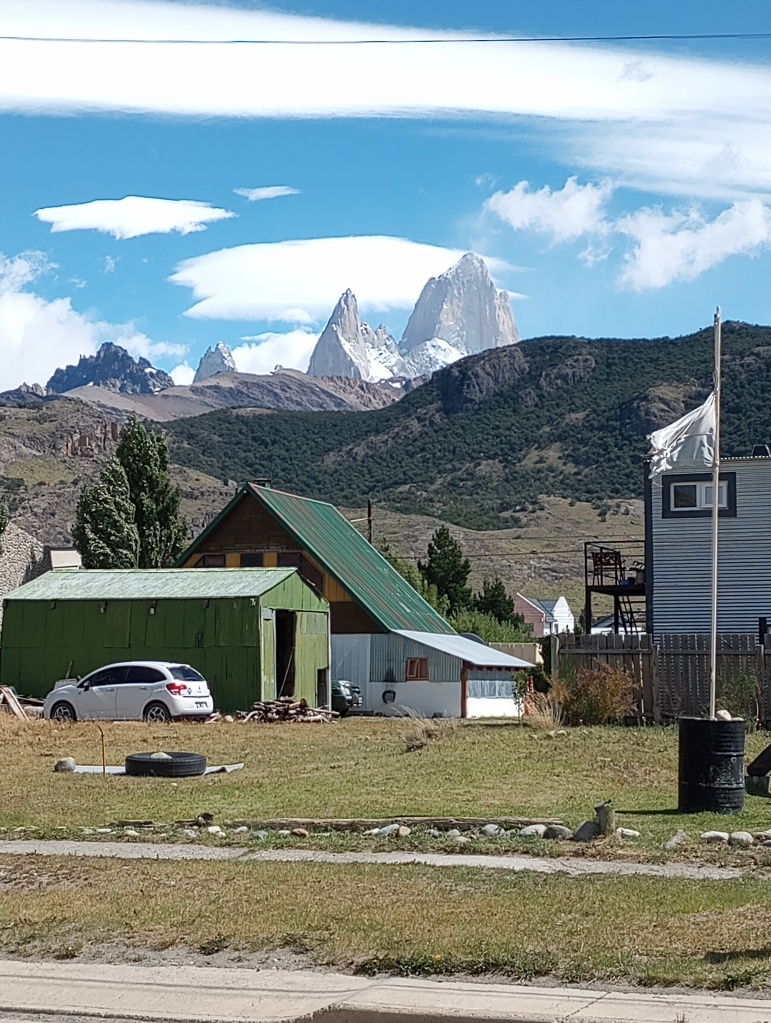
We spent a week in El Chaltén, about a three hour bus ride from El Calafate – that is, way down south in Argentina hiding in the shadow of the Andes and the Chilean border. The appeal of El Chaltén is largely the iconic Fitzroy mountain range, which is right there to the west of town, when the sky is clear. It often isn’t, and on a cloudy day, you might never know there’s much over there … not even Chile.

We came here on the recommendation of Leticia’s parents. Unlike in much of Patagonia, not having a car isn’t much of a disadvantage. There are lots of day hikes that all start just outside El Chaltén, many of them about 15 miles long. Any one of these hikes would be enough for a post filled with ridiculous scenery, and I/we did six of them in seven days.

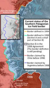
Here’s a fascinating bit of history: Argentina and Chile still do not have a settled boundary. In the late 1800s, the boundary was set along the Andes as being marked by the line of highest peaks and depending on the watershed (Pacific to Chile, Atlantic to Argentina). But the heights of the peaks weren’t known for a long time, and watersheds are even more complicated. I read somewhere that an American survey plane flying over in the 1940s found that Lago del Desierto, just north of El Chaltén, by the watershed rule should belong to Argentina rather than Chile (as previously believed). This became a minor skirmish that resulted in the death of one Chilean soldier in 1965. Arguments back and forth continued for decades. This was all finally (sort of) resolved in 1998, except for a bit almost completely covered by ice just north of El Chaltén that still shows up on lots of maps as a rectangle in which the boundary is unresolved. El Chaltén itself was founded in the early 1980s in part to establish an Argentine presence close to the border. Because of the part in the treaty about the highest peaks, there’s a skinny little piece of Chile that sticks out to the east to reach the top of Mount Fitzroy, only about 6 miles west of El Chaltén.

(Side note: going to school in Bolivia seven years ago, Anna and Zeke learned (and sang about) the land that Bolivia lost to Chile in the 1880s, making Bolivia land-locked, something Bolivians still lament. Only recently I learned that Chile gave up the eastern part of Tierra del Fuego to Argentina during that time because they had their hands full in the north. Of course – of course! – the maps at the time weren’t complete, and in 1978, Argentina and Chile almost went to war over three islands south of the big island of Tierra del Fuego. OK, digression over.)
We found a nice rhythm during this week. We all have our own hiking (and often, in my case, running) styles, and so we did some things together and some things all on our own. We often did the same hike, but on different days, and then either told each other things to look for or waited til after to share notes. All of these took place largely inside the Parque Nacional Los Glaciares. We were inside the southern part of the park when we went to the Perito Moreno Glacier a few days earlier, and we had to pay. This part, though, was free to everyone, which is great, but on the other hand, we foreigners could pay something to enjoy this amazing place.
Anyway, here are some notes:
February 7: Miradores and Park Office. 4.3 miles, 980 feet vertical gain, all together. South of town to the park office, and then out on trails to Mirador los Condores and then Mirador los Aguilas. Great views of town to the north and Lago Viedma to the south, as well as – as always – the mountains to the west.


February 8: Chorrillo del Salto. 6.5 miles, 740 feet vertical gain, solo. I went to bed the night before with a stuffy nose, cough, and sore throat, and for some time in the night I was awake with a nasty headache. Zeke went through a similar thing a day earlier. I woke up still in bad shape, and we had already planned to be on our own today. Zeke got out fairly early, and Leticia stayed around a little while, getting me set up with vitamins and tea. I slept until noon, ate a little, felt somewhat better, and went off exploring town and eventually this fairly easy hike north of town to a waterfall. Leticia came back in the afternoon tired but happy, having gone 15 miles; Zeke showed up at 6pm, full of adrenaline, having gone over 20 miles out to Laguna Toro with a side trip or two. She called it one of the best hikes of her life.

February 9: Laguna Torre. 14.8 miles, 2300 ft vertical gain, solo. Zeke and Leticia were both ready for easier days after their big walks, and I was ready to get out in the mountains. So I did the Laguna Torre hike, which Leticia had done the day before. The pattern many of these hikes follow is through woods and up valleys to glacial lakes, with better views of the big mountains around every corner. It ended with a slow walk around the rim of Laguna Torre (so named because it sits at the foot of Cerro Torre) to a lookout, where you can see the glacier come down into the lake.


February 10: Loma del Pliegue Tumbado. 13 miles, 4080 ft vertical gain (max altitude 4967), all three of us. The name means “Hill of the Lying Fold”, referring to the geology of strata actually folding over on top of itself. Another amazing hike up through woods and eventually out onto a clear rocky area, with a steep half mile up what seemed like a black rockpile to get to the top.


There’s so much more! I’ll put the last three days in another post.


I just love the fact that when I look this up on Google Maps, the border between Argentina and Chile just…disappears…for a bit right around this area. I love the fact that areas where the border isn’t quite decided still exist. Of course, I live in a place where…well, the borders are decided but weird (see Point Roberts, U.S. exclave) and we can look out to mountains almost no one has climbed.
It’s like there’s still a little mystery in the world…